This past week I spent a super day with the staff at North Surrey Secondary School (B.C., Canada) investigating various aspects of student engagement. In the afternoon we focused on the Walking Curriculum and ways walking-based activities could be used to take a more Place-based approach to teaching. I asked the educators to get outside walking. In department groups they discussed how they could get their students out walking as a feature of their learning. How could the Place contribute to student understanding? What does the Place teach about the topic? Here are their ideas:
NOTE: The activities below link to the Walking Curriculum from imaginED and to an imaginative, ecological approach to teaching. These walking-based activities can help your students learn the curriculum and develop a sense of place and community. Find out how to #getoutside with your students here –The Walking Curriculum is for K-12. (The resource provides important information for setting the imaginative context! Planning is very important!) You will notice terms in bold below. These cognitive tools will support your students imaginative engagement in these activities. Be sure to click those links for more information.
Science (Biology)
Success(ion) Walks
Getting outside with students in the sciences offers lots of opportunities to find the living examples of what is studying inside! Like the “Eco-Photojournalism” activity describes above, students can use their phones to take pictures that provide evidence of different biological concepts. These include: primary and secondary ecological succession, invasive versus native species, lichens, abiotic/biotic factors, effects of human impact on the natural world, relationships (mutualism, commensalism etc.), the food chain and organisms within it.
Weed Walks
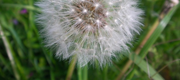
Ask Google “What is a weed?” And you get this: “A weed is a wild plant growing where it is not wanted and in competition with cultivated plants.” Does this sound like a matter of perspective to you? Who decides if these organisms are unwanted? In this exercise students can search for “weeds” and decide for themselves if they deserve their “bad” reputation. They can take photographs or draw and label what they discover. There are many weeds to choose from as they come in broadleaf (e.g. clover, dandelion) or grassy types (e.g. pampas grass and bermuda grass) and they grow all year round, being annuals, biennials, or perennials. Studying seed dispersal (genius?): How do weeds keep on “weeding”? Heroic qualities: What if we didn’t frame weeds as “bad” but instead looked at them in the heroic light of resiliency? Or persistence? Don’t they deserve some respect? (Give students a list of heroic qualities to choose from: what are “weed” superpowers?) Metaphor: How is “weed” language used in our vernacular? What do we learn about weeds from the weed analogies that we use everyday? (She is growing like a weed! We need to weed out this or that…)
Looking For Plants Walk
Get students outside to find four different types of plants. Students can write down observations of each type and details of the environment in which it is found. They can discuss how each reproduces and what adaptations have allowed the plants to thrive. Change of context: As you know, phenology is “the study of periodic plant and animal life cycle events and how these are influenced by seasonal and interannual variations in climate, as well as habitat factors (such as elevation).” (Source) Over the course of your unit of study (or the whole semester ideally) engage students as phenologists. Allow them to pick one plant or spot at the start of the semester that they will return to regularly to observe and to make detailed observations how it changes over time/seasonally/daily. Students can take notes in a journal and take photos to track changes.
English
Creative Writing & Walking
Students can become “Eco-Photojournalists”. Armed with their phones (we know most will have those!), students can take a picture of something to represent a theme or idea in a poem or piece of literature or text (e.g. freedom, imprisonment, identity, hope, despair etc.) Abstract binary opposites: Students can take a picture of something that represents the central poem/book theme but also to take a picture of the opposite of this idea (e.g. security/danger; happiness/sadness; help/hinder; lost/found etc.) [Note: Identifying the underlying dramatic tension can help frame students’ understanding and is a powerful tool of the imagination.]
Using archived photos of the school or neighbourhood site, students can create a narrative that connects the “then” with the “now”. Encourage students to obsess over details. Encourage them to investigate the old photo like they would a crime scene—what tiny details do they see that reveal something possibly important about the events of the time/day the photo was taken? Using as vivid and descriptive language as possible, ask students to tell the story of the photo in a way that evokes images in the minds of their peers. Students should walk around the current place captured in the photograph—what has changed? Why and how? (Of course, they can use their creative authorship here to describe some key people involved in the past and present scenarios. Encourage students to humanize their writing by including the characterization of real people—dead or alive—who were involved in this Place.)
Create visual “poems” of the Place. Engage the literate eye and metaphor: Ask students to head outdoors and to draw a free-hand map of the area. Then ask them to think of single terms/ideas/concepts that could represent the places on the map. What about asking students to associate different books/poems they have read with different areas of the Place? What is the connection? (This would be a wonderful way to have students think metaphorically!) If this Place was a “library” holding each text/poem, where would each sit and why? Students could also associate different locations in the outdoor space with different features of grammar or with literary terms (Where would alliteration or personification or hyperbole be?). Justification of their choices should reveal they have an understanding of these concepts. Technological tools: Students can do sketching using this Tayasui Sketches program or photographic collages using Canva or Pictochart).
Modern Languages (French/Spanish/Punjabi)
Using The Language Walk
Many aspects of students’ communication and/or vocabulary development can be enhanced through walking. For example, students practice giving directions outdoors, leading one another to predetermined destinations (in the target language). (Challenge students to take on a “treasure map” mentality—to identify a secret spot and see if they can accurately lead a friend there.). Teachers can take any/all vocabulary development and extend that into the community—what role plays or reenactments could take place outdoors? In what ways could students enact different active verbs they are learning? Students could be enlisted as architects—and equipped with the proper language vocabulary tools—walking around the school, what plans would they propose for redesign? What measurements (in the target language) are required? Using compare/contract language how does this school compare with schools in Francophone countries? (Teachers will have to modify the language structures to meet the needs of students, but with a little ingenuity can easily do so in ways that get kids involved in imaginative, outdoor practices.)
Business Education
Innovation(s) Walk: Think Like An Entrepreneur
Students can examine the local community in more detail and think about re-designing a distribution chain to be less car-centric. They can do a survey of the types of businesses around their school and provide a rationale for what other businesses would be good. Role play: Thinking like entrepreneurs, what particular innovations would increase walking in the community? What advertisements could students design (possibly using Canva or Pictochart) to encourage walking?
Math
(Property) Values Walk
What would it cost to purchase land/buildings in this area? Students can walk the local community and notice what is listed “For Sale”—they can note the locations of these places, the approximate size of lots etc. What are the listed prices for the buildings/homes? How do these prices compare with property values in the past? What impacts property value? (Extension: Create a scenario in which students buy something and have them work out the costs of the loans/interest/mortgage/bank payments etc. There are a whole load of TAXES involved in property sales…what can they find out about them? What can they calculate?
Data Walk
Walking can be a means for students to collect data on a range of topics. For example, they can work in pairs to observe and keep track of the number of cars that pass on a local street that contain one person or more than one person. They could track the number of bicycles they see in a period of time or how many pedestrians they encounter. Students could track the frequency of different forms of public transit. They could look at the school’s parking lot: how many vehicles in total? What makes/models? And based on the number of people in the school who can drive, what is the % of people who drive? Once data of any kind has been collected it can be plotted on a double bar graph—data could be collected at different times of the day/week as well and also plotted to make comparisons and draw some conclusions. What does the data analysis say about the local community? Environment? (Final analysis will depend on what data is collected of course!)
Social Studies/Humanities/Geography
What is society? Walk
Send students out to find photographic evidence of components of “society”. (You may discuss ahead of time what those components could/would be, or leave that up to your students.) Your students can use their phones (they will like this) to take pictures of “evidence” of those components (e.g. government, environment, health etc.) Engage The Literate Eye: Ask students to create a visual collage with the images (Idea: Use Canva to create a graphic design). Alternatively encourage students to use words to evoke detailed vivid mental images of some aspect of the walk (their descriptions should be very detailed, with as many descriptive features as possible). They can read these to the class and explain how the image represents “society”. Alternatively, the visual collages can serve as talking points. Extend the activity: ask students to trace one chosen aspect of “society” that they photographed into the past—how has it changed in this place?—and project into the future. (Connect to elements of historical thinking: continuity & change; cause and consequence.)
In this walking theme students could take an inventory of how physical space is used and look at the impact this use has on the natural environment. They could create a graphic indicating previous use (speculate/research), current use, and potential other future use. For each category the environmental impact can be considered. Extremes & Limits: Ask students to find what they consider to be the most environmentally damaging/dangerous use of the schoolyard/local area (predefine the parameters for the activity). What is the least damaging? For each response students should outline the various forms of impact: on soil/water/air quality; human community etc. Sense of Wonder: Do an inquiry-based walking activity where students use walking to answer/investigate a personal inquiry question. Encourage them to look at the world as if they have never seen it before—what “ordinary” thing does extraordinary things? Or, what natural (“ordinary”) feature of the environment is actually an unsung hero for the health of this Place? Why? How? What evidence can they find of this heroism on their walk? (The evidence may not be evident to the human eye of course…but with the proper tools—and superpowers—what would they see this heroic thing doing to support the health of this Place?) Conversely, what object in the place is a villain? What is this object doing to harm the community? Consider using Spark Video to demonstrate understanding.
Walking: Supporting Students With Special Needs
The teachers working with students with special needs at North Surrey Secondary provide them with ongoing opportunities to walk in the local community, the school garden, and Tynehead Park. They notice that walking through the local park, school garden as well as more broadly in the community helps their students to feel more comfortable outdoors and helps them to develop emotional connections with nature. These teachers use walking-based activities to teach students about their role as community-members and citizens and what they can do to help keep the natural environment healthy, safe, and sustainable.
Note: North Surrey Secondary School in Surrey, B.C., Canada is situated near a gorgeous natural area called Tynehead Regional Park. This is a fantastic resource for these teachers. In addition to offering a beautiful natural setting, there are ongoing opportunities in the Park to get involved in preserving it—all powerful for tapping into students’ sense of agency (e.g. opportunities to work with other volunteers to remove invasive species and plant native trees, the “Green Links Enhancement Project” which focuses on the bike/walking green belt nearby etc.). North Surrey Secondary School also has a school garden and neighboring “green way” pedestrian and bike lanes.
Thanks to the inspiring teachers at North Surrey Secondary School for these great ideas!
